The quick answer
Madagascar does not have one climate. It has at least three, and they are separated by altitude and by which side of the island you are on. The cool season runs roughly May to October and the hot, wet season November to April, with cyclones possible in the wet months.
Why altitude matters more than you expect
Antananarivo and the central highlands sit high enough that the FCDO lists altitude sickness as a risk in parts of Madagascar. In practice, what most visitors notice first is temperature: the highlands are genuinely cool, and cold at night in the middle of the year, on an island most people picture as tropical. Travelers who packed only for the coast are the ones shivering in Antananarivo in July.
The three broad zones
The central highlands
Cool and temperate, with a marked dry season from about May to October and rain concentrated in the hot months. This is Antananarivo, Ambositra, Fianarantsoa and the Royal Hill of Ambohimanga. Layers, not shorts.
The east coast and the eastern escarpment
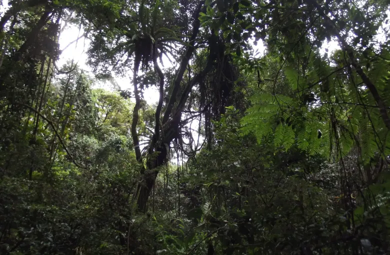
Hot and humid, and the wettest part of the island. The rainforest of the Rainforests of the Atsinanana exists because of this: UNESCO describes the property as relict forests largely associated with steeper terrain along the eastern escarpment. Rain is possible in any month, and the wet season is genuinely wet.
The west and southwest
Much drier, and hot. The Andrefana Dry Forests are inscribed precisely for their dry and thorny forest, which UNESCO describes as a continuum of dry to arid forest formations from north to south. Here the question is not whether it will rain but how hot it will be and whether the tracks are open.
⚠ Cyclone season, and what it actually does
The wet months bring the risk of tropical cyclones. The practical effect on a trip is rarely a storm you sit through in a hotel. It is roads. Unsealed tracks in the west become impassable, bridges and ferries go out of service, and internal flights are canceled or rescheduled.
The FCDO's own road warnings are already serious in the dry season, and the wet season compounds them: it notes that roads in the southern triangle are in poor condition even normally. If you are traveling between November and April, build spare days into the itinerary and do not book a flight home the morning after a long overland leg.
Month by month, in broad terms
- May to September. The cool, dry months. Best conditions for the west and the southwest, comfortable in the highlands by day and cold at night. The most reliable travel window.
- October and November. Warming up, still largely dry in the west. Many find this the most pleasant compromise.
- December to March. Hot, wet, and the cyclone window. Rainforest is at its most alive and its most difficult. Some lodges and tracks close.
- April. The rains easing. Green, fewer visitors, and roads still recovering.
What this means for what you pack
Almost everyone underpacks for the highlands and overpacks for the coast. A fleece or a light down layer earns its space between May and September, and a genuine rain layer earns it in any month if you are going east. See Madagascar Packing List.
For which of these months suits the trip you actually want, see Best Time to Visit Madagascar.
Sources
- UK Foreign, Commonwealth & Development Office: Madagascar health advice: the emergency number, the named health risks, unsafe tap water and what the hospitals in Antananarivo can and cannot do. Accessed 14 September 2026.
- UK Foreign, Commonwealth & Development Office: Madagascar safety and security: crime, beaches, vehicle crime, the advice against taxi-brousses and the false-police warning. Accessed 14 September 2026.
- UNESCO World Heritage Centre: the inscription of the Andrefana Dry Forests and the six protected areas that make up the property. Accessed 14 September 2026.
- UNESCO World Heritage Centre: the inscription of the Rainforests of the Atsinanana and its statement of Outstanding Universal Value. Accessed 14 September 2026.
Other Articles
Best Time to Visit Madagascar
Madagascar Packing List