The short version
Mosi-oa-Tunya / Victoria Falls is the only inscribed UNESCO World Heritage Site in Zambia, and it is not Zambia’s alone: it is a transboundary property shared with Zimbabwe. The Zambian side lies within Mosi-oa-Tunya National Park, and the town of Livingstone is its gateway.
The name
The Lozi name Mosi-oa-Tunya — “the smoke that thunders” — describes the thing exactly: a column of spray visible from far off, and a sound you feel before you identify it. David Livingstone reached the falls in 1855 and named them for Queen Victoria; the UNESCO inscription carries both names, and Zambians generally use the older one.
What you are actually looking at
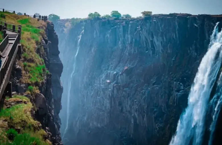
The Zambezi crosses a flat basalt plateau and drops abruptly into a narrow chasm running at right angles to the river, then escapes through a zigzag of gorges cut along ancient fault lines. That geometry is why this waterfall is unusual: you are not looking at it from below, but standing on the opposite lip of a slot, more or less level with the top of the falls, close enough to be soaked.
It is neither the tallest nor the widest waterfall on earth. The claim usually made for it is that the combination of height and width produces the largest single sheet of falling water — and whatever the arithmetic, standing on the Knife-Edge Bridge in April settles the argument.
Zambia or Zimbabwe?
A question every visitor asks, and the honest answer is that they are different experiences.
The Zimbabwean side faces the main curtain and holds water later into the dry season, giving the broad postcard view. The Zambian side puts you on top of and inside the falls: closer, wetter, more vertiginous, with the Knife-Edge Bridge, the Boiling Pot and access to Livingstone Island at the very lip. In the low-water months the Zambian side can run nearly dry in places, which is exactly when the Zimbabwean side still performs.
If your dates are flexible and the falls are the point of the trip, seeing both is worth the border crossing. Ask about the KAZA UNIVISA (see visa and entry requirements).
What to do on the Zambian side
- The Knife-Edge Bridge. The signature walk, out across a footbridge to a promontory facing the Eastern Cataract. Spectacular, and in high water a drenching — the spray falls as heavy, continuous rain.
- The Boiling Pot. A steep path down to the churning pool where the river turns into the gorge, beneath the Victoria Falls Bridge. A real descent and a real climb back.
- Livingstone Island. A guided trip to the island at the lip of the falls, in low water only, run by licensed operators.
- Devil’s Pool. The natural rock pool at the very edge, reached from Livingstone Island. Seasonal and operator-run; it does not open when the water is high, and it cannot be attempted independently. If it matters to you, it constrains your dates.
- The Victoria Falls Bridge. The 1905 steel arch to Zimbabwe, walkable with the right paperwork, and a fine view of the gorge. Do not photograph the border infrastructure.
- Mosi-oa-Tunya National Park. The small park upstream, with white rhino among other game — a good half-day for anyone not continuing to a bigger park.
Timing your visit
This is the crux, and our best time to visit guide covers it fully. Briefly: peak flow is roughly February to May, when the falls are overwhelming and the view is largely spray; the water drops through the second half of the year, and by October and November the Zambian side can expose bare rock. Neither is wrong; they are different sights.
Practicalities
- A rain shell and a dry bag in the high-water months, and shoes with grip in any month. The paths are wet stone.
- Park entry is payable at the gate; carry kwacha as well as a card.
- Watch your footing. There are unfenced edges. See our safety guide.
- Vervet monkeys and baboons will take food from your hand. Do not carry it openly.
- Early morning is quieter and the light is better; rainbows in the spray are a morning phenomenon, and lunar rainbows appear around full moon in the high-water season.
Access
The main paths and several principal viewpoints are paved and level; the Knife-Edge Bridge and the Boiling Pot path are not. Our accessibility guide sets out what that means in practice.
Visiting with LABUSA Travel
We will tell you what the falls will actually look like in your month rather than showing you a high-water photograph and letting you find out, and we will build the rest of the trip so that the answer does not ruin it.
Other Articles
Best Time to Visit Zambia
Accessible Travel in Zambia