On the equator the sun rises at about six and sets at about six, every day of the year, give or take a few minutes. There is no long summer evening in Ecuador and no dark winter afternoon. What replaces the seasons is height: every thousand meters of elevation takes roughly six degrees off the temperature, and Ecuador spans sea level to well over five thousand.
What each region actually feels like
- Quito and the northern highlands, about 2,850 m. Daytime highs in the high teens or low twenties Celsius all year, nights close to single figures. Strong sun, thin air, rapid changes. Rain tends to arrive in the afternoon.
- Cuenca and the southern highlands, about 2,550 m. A little milder and a little drier than Quito, with the same daily swing.
- The paramo above about 3,500 m. Cold, wet, windy and exposed, with weather that turns inside an hour. This is the country's most underestimated environment.
- The coast, at sea level. Hot and humid all year. Wettest and brightest from about January to April, cooler and grayer from June to November.
- The Amazon, at a few hundred meters. Warm, humid and wet throughout, with no month that is reliably dry.
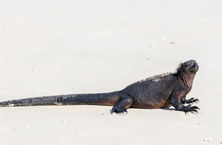
- The Galapagos, at sea level on the equator. Moderated by the sea. Warmer and calmer from about December to May, cooler and windier from June to November.
The equatorial sun is the thing people get wrong
Ultraviolet levels in the Ecuadorian highlands are among the highest recorded anywhere, because the sun is directly overhead and there is a kilometer less atmosphere above you than at sea level. Cloud makes very little difference to that. Sunburn on an overcast highland afternoon is one of the most common and most avoidable things that happens to visitors here.
Altitude and weather are the same subject
Cold, wind and thin air compound each other. Altitude sickness is a real risk in Ecuador, and Quito at about 2,850 m is where most visitors meet it first. Acclimatize before you go higher, never during. Give the first day to arriving rather than to doing anything, and treat a planned ascent of any of the volcanoes as a separate undertaking with its own preparation.
Reading a forecast here
A national forecast for Ecuador is close to meaningless. A forecast for a named town at a named altitude is useful. If you are moving between regions in a single day, which is easy to do, expect the weather to change completely rather than gradually.
See the best time to visit for how these regimes translate into months, and the packing list for what they mean in a bag.
Sources
- UK Foreign, Commonwealth & Development Office: Ecuador travel advice: the standing warning that the FCDO advises against all but essential travel to parts of Ecuador, the Coastal Region province list, the twenty kilometer strip along the Colombian border, and the state of emergency declared on 15 September 2026 for sixty days in eight provinces including Pichincha. Accessed 17 September 2026.
- Centers for Disease Control and Prevention: Ecuador traveler health: yellow fever vaccine recommended for travelers aged nine months and over going below 2,300 m east of the Andes in Morona-Santiago, Napo, Orellana, Pastaza, Sucumbios, Tungurahua and Zamora-Chinchipe, generally not recommended west of the Andes and not recommended above 2,300 m; malaria transmission below 1,500 m in Cotopaxi, Esmeraldas, Morona-Santiago, Orellana, Pastaza and Sucumbios with rare cases below 1,500 m elsewhere, no transmission in the cities of Guayaquil or Quito, and no transmission on the Galapagos Islands. Accessed 17 September 2026.
Other Articles
Best Time to Visit Ecuador
What to Pack for Ecuador