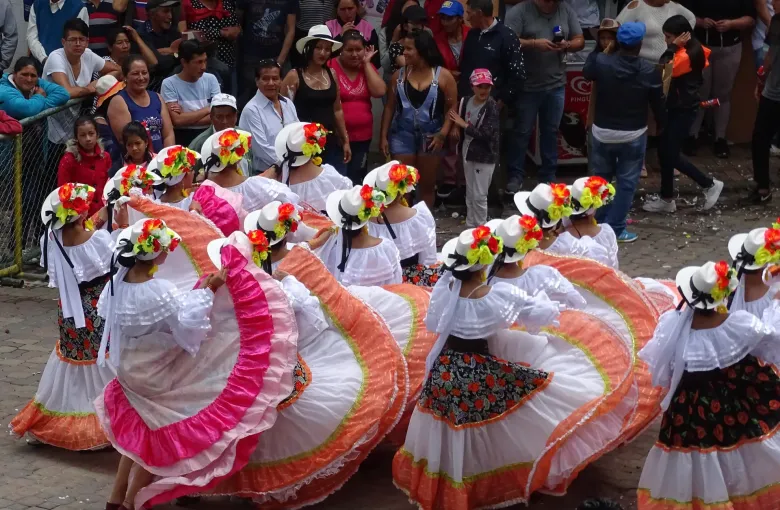
The Historic Centre of Santa Ana de los Rios de Cuenca was inscribed on the World Heritage List in 1999. The property is the colonial core of Ecuador's third city, and what it is cited for is not a single building but a plan: a Renaissance grid laid out in 1557, following instructions issued from Spain, and followed closely enough that you can still read the original intention off a modern map.
Why the grid matters
Sixteenth century Spanish colonial towns were founded to a written specification. A central square with the church on one side and the civic buildings on the others, streets running out from it at right angles, blocks of a standard size. Most such towns were subsequently pulled about by growth. Cuenca was not, largely because it stayed small and provincial for three hundred years, and the result is that the plan is the monument.
The river terraces on the southern edge are the other half of the inscription. Four rivers run through the city and the old town sits on the terrace above one of them, which is why the approach from the south is the view everyone photographs.
What to see
- Parque Calderon, the main square, with the blue-domed New Cathedral on one side and the much older and smaller Old Cathedral facing it across the trees. The pairing is the city's signature.
- The flower market beside the Carmelite convent, which operates every day and is one of the pleasanter public spaces in the country.
- The riverside walk along the Tomebamba, where the colonial terrace drops away to the water and the scale of the old town is clearest.
- Todos Santos and the Inca and Canari remains at the eastern end, which are the reminder that the Spanish built on top of an existing city rather than on empty ground.
Panama hats are from here
The hat known everywhere as a Panama hat is Ecuadorian. It is woven from toquilla straw, in and around Cuenca and on the coast at Montecristi, and acquired its name because the hats were shipped through Panama to the world. The finest weaves take months and are made by a shrinking number of weavers. There are workshops and a hat museum in the city where the process is demonstrated, and it is worth an hour even if you have no intention of buying one.
Practicalities
Cuenca sits at about 2,550 m, a little lower and a little milder than Quito, and the daily swing between a cold morning and a strong midday sun is the same. Most visitors arrive having already spent time in the highlands, which makes the altitude a non-event; if Cuenca is your first stop, give it the same slow first day.
The city is compact enough to cover on foot and flat enough inside the grid that walking is genuinely easy, which is unusual among Ecuador's highland cities and is the reason the accessibility guide treats it separately.
See also the City of Quito and the Galapagos Islands, the other two of Ecuador's five inscribed properties covered in this cluster.
Sources
- UNESCO World Heritage Centre: Historic Centre of Santa Ana de los Rios de Cuenca, inscribed 1999, recording the Renaissance grid laid out in 1557 and its survival in the modern city. Accessed 17 September 2026.
- UNESCO World Heritage Centre: Ecuador States Party record: five properties inscribed on the World Heritage List, three cultural and two natural, together with a tentative list of fifteen further sites. Accessed 17 September 2026.
- Centers for Disease Control and Prevention: Ecuador traveler health: yellow fever vaccine recommended for travelers aged nine months and over going below 2,300 m east of the Andes in Morona-Santiago, Napo, Orellana, Pastaza, Sucumbios, Tungurahua and Zamora-Chinchipe, generally not recommended west of the Andes and not recommended above 2,300 m; malaria transmission below 1,500 m in Cotopaxi, Esmeraldas, Morona-Santiago, Orellana, Pastaza and Sucumbios with rare cases below 1,500 m elsewhere, no transmission in the cities of Guayaquil or Quito, and no transmission on the Galapagos Islands. Accessed 17 September 2026.
Other Articles

Afro-Ecuadorian Heritage and Reconnection
The Galapagos Islands