What the valley is
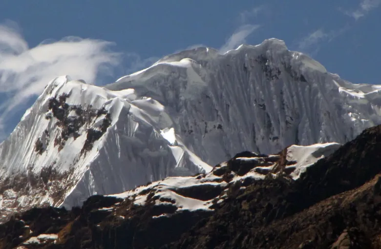
The Urubamba runs northwest from near Cusco toward Machu Picchu, through a broad valley at around 2,800 meters: lower, warmer and more fertile than the city above it. That is why the Inca state built here. It fed the capital.
The valley is not a single inscribed property. It is the setting between two inscriptions, the City of Cuzco at one end and the Historic Sanctuary of Machu Picchu at the other, and it is crossed by the Qhapaq Nan, the Andean Road System, itself inscribed on the World Heritage List in 2014 as one of Peru's thirteen properties. Understanding the valley as the connective tissue between them is more useful than treating it as a list of stops.
Why to start here rather than in Cusco
Cusco sits at 3,400 meters. The valley is roughly six hundred meters lower, and altitude sickness is a serious risk in Cusco. Transferring straight from the airport down to the valley, spending the first nights there and coming up to the city later is the single most effective change most Peru itineraries can make, and it costs nothing.
Sleeping lower and visiting higher is how acclimatization works. The valley makes that the natural shape of the trip rather than a special arrangement.
Pisac
Terraces sweeping around a mountainside below a ridge top complex of temples, baths and watchtowers, with the largest Inca cemetery known cut into the cliff opposite. The market in the town below is well known and busy; the site above it is the reason to come, and far fewer visitors climb to the top of it.
Go up by road and walk down through the terraces if you can arrange it. That direction is easier at altitude and it is the better sequence for seeing how the site is built.
Ollantaytambo
The most complete surviving example of Inca town planning: the original street grid is still in use, with the canals running through it, and people still live in the buildings. It is also the place where an Inca army defeated a Spanish force, which makes it unusual.
The terraces above the town climb to an unfinished temple of enormous pink porphyry blocks quarried on the far side of the valley and brought across the river. Standing there and looking at the quarry is the clearest lesson in Inca engineering available anywhere.
Ollantaytambo is also the practical rail head for Machu Picchu, so many visitors pass through it without stopping. Stop.
Moray and Maras
Moray is a set of enormous concentric agricultural terraces sunk into the ground, each ring at a measurably different temperature. It is generally understood as a place where crops were adapted to different conditions, which fits what UNESCO says about Machu Picchu and Inca plant domestication, though its purpose is not settled.
Maras is thousands of small salt pans on a hillside, fed by a saline spring and worked since before the Inca state, still operated by local families. It is the most photographed place in the valley and it remains a working industry rather than a display.
Chinchero and the weaving
A village on the high road toward Cusco with Inca terracing, a colonial church built on Inca foundations, and a living weaving tradition. The cooperatives there demonstrate the whole process from fleece to dye to finished cloth. Buying directly from them is the recommendation in our Peru culture and etiquette guide, and this is the place to do it.
Practical notes
- Several sites are covered by a combined tourist ticket rather than sold individually. Check what your ticket includes before setting out, and how many days it lasts.
- Distances are short and the roads are winding. A driver for a day covers more than public transport will.
- Afternoons in the rainy season bring rain. Start early.
- The valley is where the Machu Picchu trains leave from, so build the two into one sequence rather than returning to Cusco in between.
- Accommodation here is often single story and set in gardens, which matters for the reasons our accessible travel guide sets out.
Verify before you travel
Ticket arrangements, site opening and train departures change. Confirm them locally before committing to a day plan.
Sources
- UNESCO World Heritage Centre: the inscription of the City of Cuzco in 1983, recording the city at 3,400 meters, its remodelling under Pachacuteq in the fifteenth century as the capital of the Tawantinsuyu, and the Inca stone construction of the Qoricancha and the surviving pre-Hispanic street pattern. Accessed 16 September 2026.
- UNESCO World Heritage Centre: Peru's State Party record: thirteen properties inscribed on the World Heritage List, nine cultural, two natural and two mixed, and the ratification of the Convention on 24 February 1982. Accessed 16 September 2026.
- UK Foreign, Commonwealth & Development Office: Peru health: the ambulance number 106, the eight week lead time before travel, altitude sickness named as a serious risk in Cusco, Puno, the Colca Canyon and Kuelap, the dengue outbreak following floods, and the difficulty of accessing medical treatment outside Lima. Accessed 16 September 2026.
Other Articles
Best Time to Visit Peru
Accessible Travel in Peru