The short version
Brazil spans from just north of the equator to well into the temperate south. Treating it as one climate produces the classic mistake: packing for Rio and then flying to Manaus or to Porto Alegre.
The organizing idea that works better than temperature is rainfall. In most of Brazil the year divides into wetter and drier rather than hot and cold, and it is the rain that decides whether a road is passable, whether a waterfall is at full volume, whether a lagoon exists at all, and how much of the day you will spend indoors.
The southeast: Rio, Sao Paulo, Minas Gerais
This is the Brazil most visitors see. Summer, from December through February, is hot and humid with heavy afternoon rain that arrives and clears. Winter, from June through August, is milder and drier, with clearer air and better long views, which matters more than it sounds in a city whose World Heritage inscription is a landscape running from the Tijuca massif at 1,021 meters down to the sea.
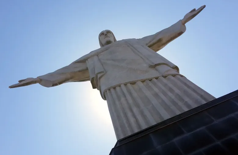
Cloud on Corcovado is the specific weather problem in Rio. The statue and the viewpoint can be inside a cloud while the beach three kilometers away is in full sun. If the view is the reason you are going up, go early and be willing to change the day.
The northeastern coast: Bahia to Ceara
Hot all year, with the sea breeze doing most of the work of making it bearable. The wet months here do not match the southeast's, which is the single most useful fact in this guide for anybody combining Salvador with Rio.
Further along the coast into Maranhao, the rain is not an inconvenience but the entire attraction. The lagoons of Lencois Maranhenses, inscribed in 2024, are rain fed. They fill after the wet season and shrink away afterwards, so the park is a different place depending on when you stand in it.
The Amazon basin
Warm and humid all year, with rain in every month and a pronounced high water and low water cycle rather than a dry season in the usual sense. The Central Amazon Conservation Complex, inscribed in 2000 and extended in 2003, is built around exactly this: its varzea floodplain and igapo flooded forest are defined by water that rises and falls, and the World Heritage description calls the result a constantly evolving aquatic mosaic.
Practically, high water means more of the forest is reachable by boat and more of the wildlife is concentrated along the edges. Low water means beaches, walking trails and easier land travel. Neither is the wet season in the sense of being unusable.
The interior: Brasilia, Goias, the cerrado
The central plateau has the sharpest wet and dry split in the country. The dry months are genuinely dry, dusty and clear, with cold nights that surprise people who have only read about tropical Brazil. The wet months bring intense afternoon storms.
The south: Parana, Santa Catarina, Rio Grande do Sul
Properly temperate, with four seasons that a visitor from North America or Europe would recognize. Winters are cold, frost happens, and the higher ground occasionally sees snow. This is also where Iguacu sits, on the Parana border, where the falls are at their most violent in the wetter months and at their most walkable when the water drops.
Two weather facts that are health facts
High UV levels are named as a health risk for Brazil, and they apply on cloudy days and on the water as much as on a beach in January. Sun protection is not a summer only concern in a country this close to the equator.
And rain is a mosquito question. Dengue, chikungunya and oropouche are all named for Brazil alongside yellow fever, for which vaccination is recommended across much of the country without being an entry requirement, and mosquito activity follows standing water. Wetter months mean insect precautions matter more, not less, and those precautions are the same ones that matter for the diseases there is no vaccine for. Our Brazil packing list covers what that means for what goes in the bag.
Altitude, briefly
Altitude sickness is named as a risk in parts of Brazil. It is not the dominant issue it is in the Andean countries, and nothing in the standard Rio, Salvador, Amazon itinerary raises it, but it is on the record and worth knowing if your plans take you into high country.
Verify before you travel
Regional patterns are stable; particular years are not. Check a forecast for the specific places on your route in the fortnight before you fly, and treat any single figure you read about a Brazilian month as an average rather than a promise.
Sources
- UK Foreign, Commonwealth & Development Office: Brazil health: the ambulance number 192, the eight week lead time before travel, the named health risks including yellow fever, dengue, chikungunya, oropouche and high UV, altitude sickness in parts of the country, and the entitlement of foreign nationals to emergency treatment in public hospitals. Accessed 16 September 2026.
- UNESCO World Heritage Centre: Brazil's State Party record: twenty six properties inscribed on the World Heritage List, sixteen cultural, nine natural and one mixed, including the Valongo Wharf Archaeological Site in 2017 and Lencois Maranhenses National Park in 2024. Accessed 16 September 2026.
- US Centers for Disease Control and Prevention: Travelers' Health, Brazil: the yellow fever recommendation by state and the record that the vaccine is not an entry requirement, the malaria transmission map including the absence of transmission in Brasilia, Rio de Janeiro, Sao Paulo and at Iguacu Falls, and the hepatitis A, hepatitis B, measles and rabies guidance. Accessed 16 September 2026.
Other Articles
Best Time to Visit Brazil
Brazil Packing List